Welcome to Mary Ann & Tim's travelog for the lower Hudson Valley
This is a personal website. Please do not link to it.
MA & T in the lower Hudson Valley
8 days' driving, 1816 kilometers (825 shown below).
Art
The lower Hudson Valley was the locus of the informal "Hudson School" of
painters, starting with Thomas Cole and possibly peaking with his student
Frederic Edwin Church. The light and the skies of the region are reflected in
their paintings, not to mention the spectacular landscapes.
Some history.
Newburgh was a center of industry and commerce until the 1960s when it declined
and its entrepreneurs moved out. In the 1970s it was subjected to "Urban
Renewal" which razed fine architecture and left parts looking like Europe after
WWII. Newburgh nonetheless claims to be a heartland of conservation, starting
with the saving and restoring of Washington's headquarters in Hasbrouck House
in the 19th century and resuming with the saving and restoring of houses along
Montgomery St during the "urban renewal", including our B&B.
Rosendale claims to be responsible for the industrialization of New York city
and state because of 30 square miles of limestone used to produce "natural
cement". This built the Brooklyn Bridge and the Statue of Liberty (which might
have gone to Boston or Pittsburgh except for NY industrialization) and more
fundamentally the Delaware to Hudson Canal (half of it following Rondout Creek)
which brought Pennsylvania coal to the Hudson halfway between the ports of NYC
and Albany.
Travel map.
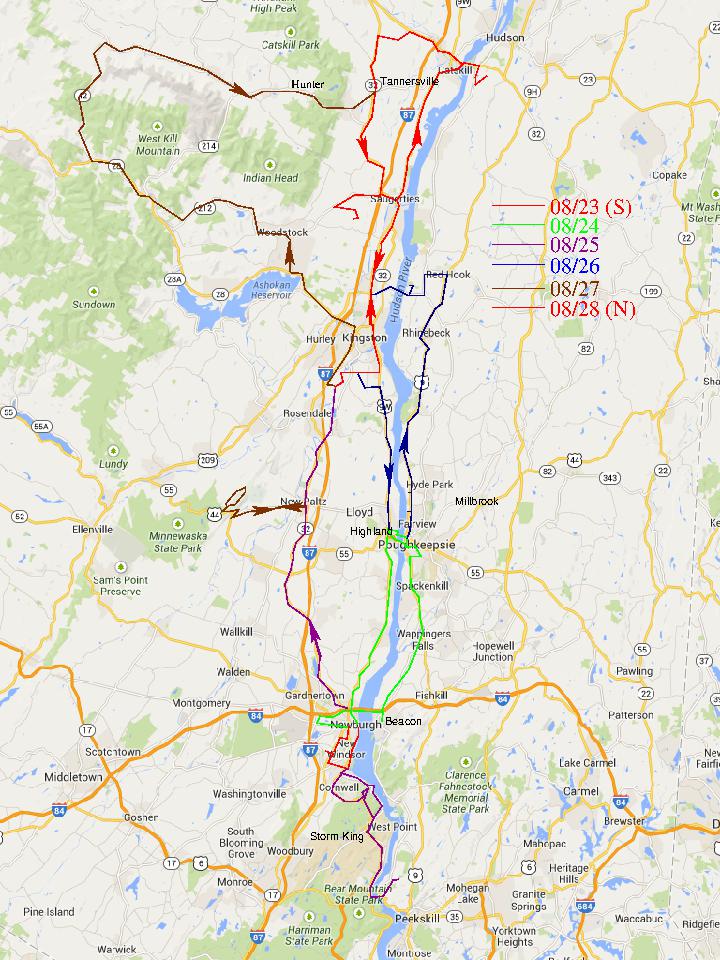
Map: T, 2014/8/30 from Google
Beds and Breakfasts, Aug. 22-29, 2014
6 photos, 1.0 Mbytes
Storm King Art Center, Aug. 23, 2014
23 photos, 4.0 Mbytes
Beacon and Poughkeepsie, Aug. 24, 2014
6 photos, 1.3 Mbytes
Storm King Mountain, Aug. 25, 2014
6 photos, 1.3 Mbytes
CIA and FDR, Aug. 26, 2014
10 photos, 1.5 Mbytes
The Gunks and a drive, Aug. 27, 2014
14 photos, 2.8 Mbytes
Olana and Opus 40, Aug. 28, 2014
15 photos, 2.7 Mbytes
Albany, Aug. 29, 2014
3 photos, 0.4 Mbytes